


UK Weather Forecast: Cold Snap and Snow Ahead
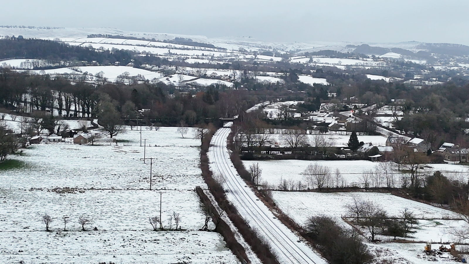
The United Kingdom is set to experience a spell of cold weather over the weekend, with forecasts predicting ice and snowfall following the recent impact of Storm Goretti. Although Saturday is expected to see clearer and drier conditions, a shift to rain and snow is anticipated by Sunday.
Weather Alerts Issued
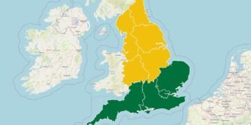
The Met Office has issued yellow weather warnings for snow and ice across a large portion of the country, with cold air making its way in overnight from Friday to Saturday. These alerts are designed to inform the public of potential hazards on roads and pavements.
- Warnings are active across most of Scotland and parts of northeastern England until Saturday afternoon.
- Another warning for snow and ice is in effect for Northern Ireland until 11 a.m. on Saturday.
- Regions in southern, western, and northwestern England, along with the East Midlands and Wales, are also under similar warnings until midday Saturday.
Impact of Storm Goretti
This past Friday, Storm Goretti brought heavy rainfall, snowfall, and strong winds to the UK, leading to power outages for tens of thousands of households. Some areas experienced high winds that resulted in fallen trees and flight cancellations.
Footage displayed the challenges faced by pilots, with one passenger aircraft noticeably swaying as it landed at Heathrow Airport, showcasing the storm’s intense conditions.
Upcoming Weather Patterns
As Saturday progresses, the weather is expected to improve, offering a quieter atmosphere. However, severe frost is predicted overnight, along with icy patches on untreated roads and walkways. The Met Office notes that temperatures will remain low, hovering between 2 to 3°C (35 to 37°F) on Saturday. Sunday may see temperatures rise to around 10°C (50°F), particularly in western regions and Northern Ireland, raising concerns about localized flooding early next week.
Looking ahead, a band of rain is predicted to arrive from the west early on Sunday, which, upon meeting cold air, could lead to further snow across the northern parts of England and Scotland, especially at higher altitudes. Areas might see between 10 to 20 cm (4 to 8 inches) of snow, with less accumulation expected in lower locales. A yellow warning for snow and ice will also be in effect from 2 a.m. to 3 p.m. on Sunday.
Background
Storm Goretti, which recently swept through the UK, serves as a stark reminder of the intense winter weather conditions that can affect the region. This situation emphasizes the importance of staying updated with weather warnings and preparing for potential disruptions that may arise from adverse weather.
For those wishing to stay informed about local forecasts or to check ongoing weather conditions, the Met Office website provides timely updates. Being aware of these developments can aid in making safer travel and planning decisions during this unpredictable weather period.
Source: Original Article