


Cold Weather Warnings Sweep Across the UK
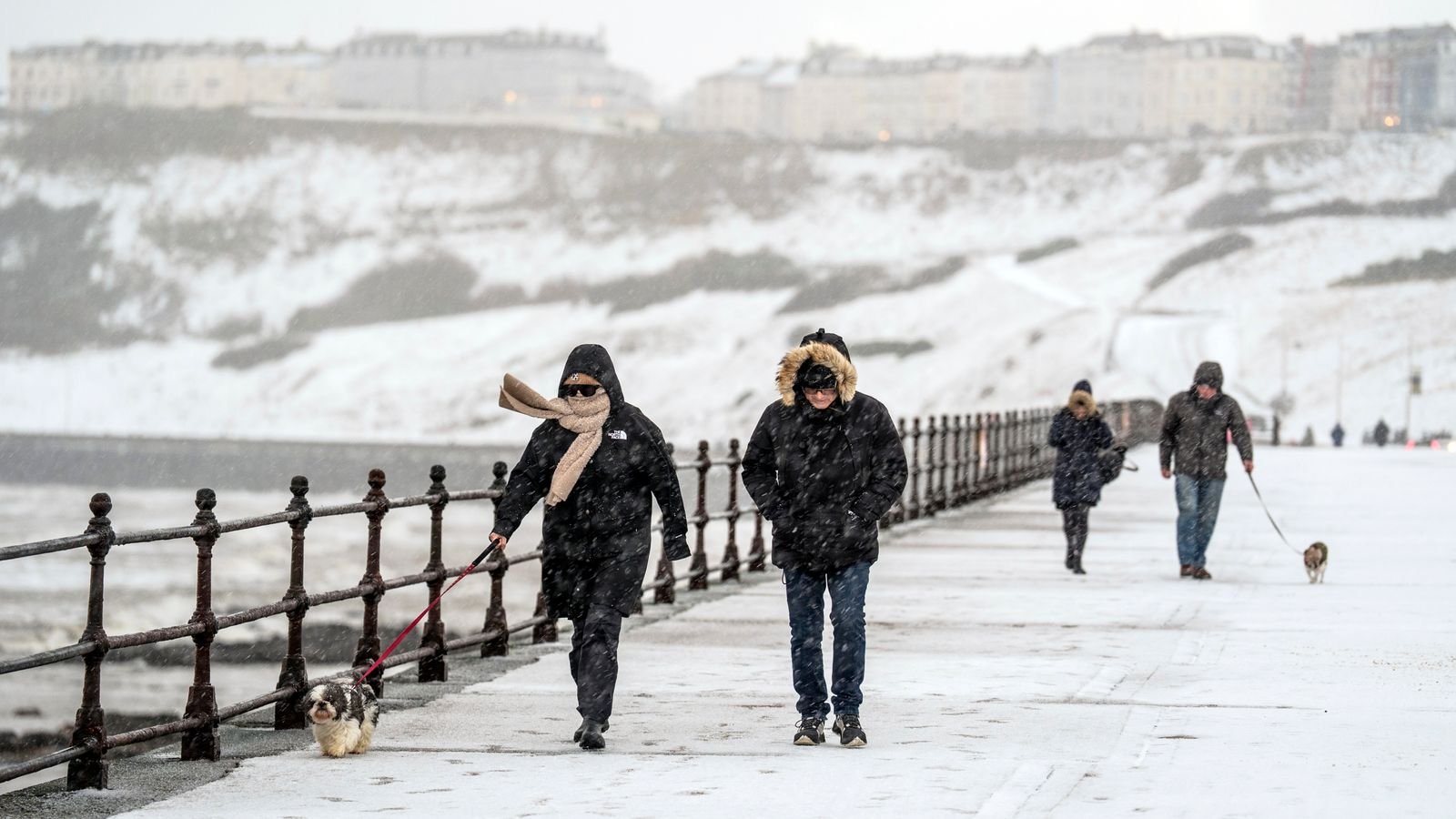
Severe cold weather alerts have been issued throughout the UK as Arctic conditions bring widespread snowfall, sleet, and hail. The intense weather has resulted in flight cancellations, disruptions to rail services, and school closures, prompting the public to remain vigilant as temperatures plummet.
Current Weather Alerts
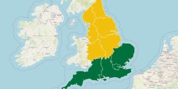
As of Monday, temperatures in some areas dropped to as low as -10.9°C, with Shap in Cumbria experiencing record lows. The Met Office has reported up to 52cm of snow in Banffshire, Scotland, and has placed yellow warnings for snow and ice across Scotland, Northern Ireland, and northern England. In addition, amber warnings for cold weather have been issued across all regions in England, remaining in effect until Friday.
Impact on Travel and Daily Life
Train services have faced significant interruptions, particularly in northern Scotland, with National Rail advising passengers of ongoing disruptions until late Tuesday. Eurostar has also advised travellers on routes from London to delay their journeys as services cannot operate beyond Brussels due to adverse conditions. Additionally, Loganair has cancelled multiple flights from Aberdeen and Inverness, while operations at Liverpool John Lennon Airport were temporarily halted.
Furthermore, City of Derry Airport and Belfast International Airport have reported several cancellations and delays due to the inclement weather. The AA has noted a 40% increase in call-outs compared to typical Mondays, signalling a resurgence of winter driving hazards.
Continuing Hazards and Predictions
According to Met Office Chief Meteorologist Matthew Lehnert, the unpredictable winter weather is expected to persist throughout the week, with low temperatures, ongoing snow showers, and the risk of icy conditions. Forecasts suggest a further 2-5cm of snow in many areas, with higher elevations possibly receiving additional accumulations.
As temperatures are set to drop below freezing again overnight into Tuesday, the Met Office warns that regions with residual snow could experience lows of around -12°C. Wintry showers will likely advance southeast across Scotland and Northern Ireland, affecting parts of Wales and England later in the day.
Potential for More Severe Weather
The Met Office has cautioned that as the week progresses, strong winds and heavy rainfall could create additional hazards across the country. Deputy Chief Meteorologist Mike Silverstone indicated uncertainty regarding the movement of an area of low pressure expected to arrive from the west on Thursday and Friday. The exact path it takes may significantly affect the type of severe weather various regions could face.
Background
Cold snaps are not unusual for the UK, especially during the winter months; however, the recent patterns of extreme weather events have raised concerns about transportation and public safety. The combination of heavy snowfall and plunging temperatures highlights the challenges faced by infrastructure and emergency services during such weather events. As climate variability continues to prompt more severe weather phenomena, understanding these patterns is crucial for both immediate responses and long-term planning.
Source: Original Article