


Important Global Events Captured by Satellite Imagery in 2023
This year has seen a series of significant global events captured through satellite imagery, providing a unique vantage point on disasters and socio-political upheavals. From catastrophic wildfires in California to powerful earthquakes and impactful protests, satellite technology has illustrated the profound effects these events have had on communities worldwide.
January: Wildfires in California
Between 7 and 31 January, California was engulfed in wildfires, primarily affecting areas in Los Angeles and San Diego. Driven by arid conditions and strong winds, these fires led to at least 30 confirmed fatalities, with estimates indicating an additional 440 deaths attributed indirectly to the disaster, based on a study published in the JAMA medical journal.
February: Attacks in Sudan
In February, armed fighters from Sudan’s Rapid Support Forces stormed the Zamzam refugee camp in North Darfur. This assault resulted in civilian casualties and extensive destruction of local infrastructure, including buildings and stalls, as aerial photos illustrated the severity of the attack amidst the ongoing civil war in Sudan.
March: Earthquake in Myanmar
A devastating earthquake measuring 7.7 on the Richter scale struck Myanmar on 28 March, leading to an estimated death toll ranging from 3,600 to 5,350, according to United Nations reports. The quake also rendered around 200,000 individuals homeless as buildings collapsed across the nation.
April: Mourning Pope Francis
On 26 April, thousands congregated outside St Peter’s Basilica in Vatican City to pay their last respects to Pope Francis, who passed away on 21 April at the age of 88. The pontiff was celebrated for his progressive stance during his 12-year papacy, drawing significant crowds during the funeral service.
May: GPS Interference in the Baltic Region
May saw an escalation in electronic jamming activities along the Baltic coast, particularly around the Russian enclave of Kaliningrad. Satellite imagery indicated that this interference, which disrupts GPS signals through powerful artificial frequencies, poses growing concerns for transportation and navigation in the region.
June: Drone Strikes on Russian Airbases
On 1 June, several Ukrainian drone attacks targeted Russian airbases, inflicting considerable damage on military aircraft. High-resolution satellite images taken on 4 June revealed the aftermath of these strikes, showcasing visible destruction and cleanup efforts at the affected bases.
July: Humanitarian Crisis in Gaza
On 26 July, satellite views captured the heartbreaking scenes in southern Gaza, where numerous individuals crowded around an aid convoy amid desperate food shortages. This situation worsened over the following month, leading to the declaration of famine in Gaza City, as assessed by global food security experts.
August: Halt on ‘Alligator Alcatraz’ Construction
In August, construction at a controversial immigration facility in Florida, dubbed ‘Alligator Alcatraz,’ was temporarily suspended due to environmental concerns. The project was met with scrutiny over its location, with experts warning of potential flooding issues that could endanger detainees and undermine safety protocols.
September: Protests in Nepal
On 9 September, youth-led protests erupted in Kathmandu, leading to the burning of Nepal’s federal parliament building. The unrest, which was fueled by a governmental decision to block multiple social media platforms, resulted in considerable casualties and significant property damage, as evidenced by satellite imagery.
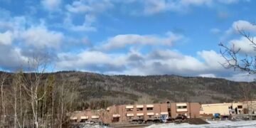
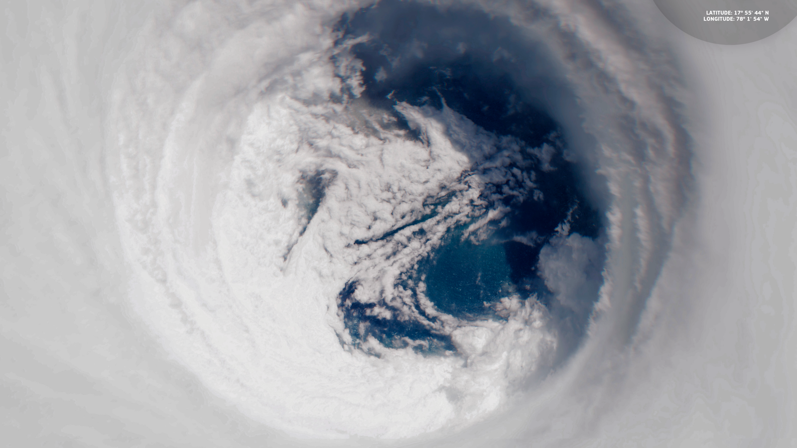
October: Hurricane Mellissa’s Devastation
October brought the catastrophic Hurricane Mellissa, the most severe storm to impact Jamaica to date. Making landfall on 28 October, the hurricane caused an estimated $8.8 billion in damages—41% of Jamaica’s GDP for 2024—by flooding, damaging buildings, and disrupting infrastructure.
November: US Naval Presence in the Caribbean
On 16 November, the USS Gerald R. Ford was deployed to the Caribbean Sea in a move deemed part of a counter-drugs operation by the US administration. However, this strategy is interpreted by many as an effort to challenge Venezuelan President Nicolás Maduro’s regime, marking a significant military presence in the area.
December: Celebratory Lights in New York City
As 2023 drew to a close, satellite images taken on 4 December showcased the festive spirit in New York City, particularly around Manhattan, as the iconic Christmas tree at Rockefeller Plaza was lit on 3 December. This vibrant display highlights the enduring cultural traditions that persist amidst global challenges.
Background
The use of satellite imagery has been increasingly vital in covering disasters and conflicts, providing crucial insights that traditional reporting methods cannot offer. In a year defined by natural disasters, humanitarian crises, and significant political events, these images serve to remind us of the vulnerabilities and resilience of communities around the world.
Source: Original Article